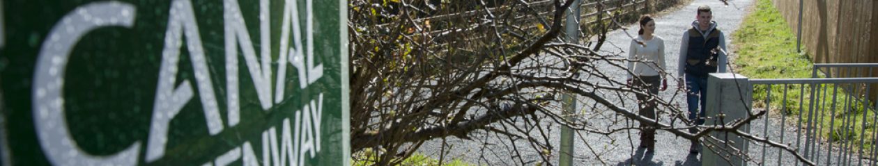
The Monaghan Town Greenway opened in 2013 and is an urban walking/cycle track that passes close to many of Monaghan Town’s residential and commercial areas. A map of the route is available here.
Key Information:
- This is a 4.2km linear route featuring a combination of urban and rural landscapes, following the path of the Ulster Canal.
- Trail Grade: Class 2, Easy. Generally flat trail with even surface and some gentle slopes. Suitable for infrequent cyclists and family
- groups. Normal footwear can
 be worn.
 - Caution: The route features some road crossings and sections adjacent to traffic, therefore it is strongly advised that children are accompanied by an adult on these sections.
- Signs and route markings featuring the Ulster Canal Greenway logo are provided along the route.
- Distance: 4.2km, which can be walked in an estimated time of 45 minutes by average users. Those who wish to walk further can continue along the Threemilehouse Road by footpath to nearby Rossmore Forest Park
- Terrain underfoot: Mainly compacted gravel. Concrete/ tarmac on some urban sections
- No big hills. Total ascent: 33m
- GPS for start point: 268119, 335044
- Emergencies: In the event of an emergency, phone 112 or 999
- Bike repairs: The nearest bike shop is Monaghan Hire, on the Dublin road. Tel 047 74444
Feedback: We welcome feedback and photos from our users. Please contact us with comments.